In that Empire, the Art of Cartography attained such Perfection that the map of a single Province occupied the entirety of a City, and the map of the Empire, the entirety of a Province. In time, those Unconscionable Maps no longer satisfied, and the Cartographers Guildsu struck a Map of the Empire which size was that of the Empire, and coincided point for point with it. The following Generations, who were not so fond of the Study of Cartography as their Forebears had been, saw that that vast Map was Useless, and not without some Pitilessness was it, that they delivered it up to the Inclemencies of Sun and Winters. In the Deserts of the West, still today, there are Tattered Ruins of that Map, inhabited by Animals and Beggars; in all the Land there is no other Relic of the Disciplines of Geography.
Jorge Luis Borges, On Exactitude in Science (1946)
Forward: the limits of cartography
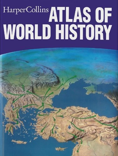
I have always had a weakness for maps. Occupying and inordinate amount of space on my bookshelf are Collins historical atlases* – heavy in both the literal and figurative sense. They are magnificent volumes, and over the years I have spent many hours tracing their pages, following the movement of armies, adventurers and archeologists, the rise and fall of empires, the migration of peoples and the shifting frontiers that have so often redrawn the world. They offer a visual way of understanding history: not simply what happened, but where it happened, how territories expanded and contracted, and how the political landscape changed beneath the feet of successive generations.
Yet maps have their limitations, and perhaps that is particularly worth remembering when maps become arguments. They can show movement and geography with remarkable clarity, but they cannot tell us everything about the people represented upon them. My Collins atlases cannot tell me a person’s ethnicity or DNA, their beliefs or ideology, their loyalties or aspirations, or what motivated them to move, conquer, settle, flee or remain. They show the where, and often the when, but not necessarily the why. A boundary drawn in ink may look definitive on a map while being porous, contested or meaningless to the people who lived on either side of it. That tension – between the map and the territory, between geography and human experience – lies behind what follows.
It is particularly relevant when looking at Palestine, a landscape whose names, boundaries and meanings have accumulated over centuries and whose maps are now routinely recruited into arguments about history, identity and belonging. We must be mindful that maps are historical artefacts before they are political weapons. They tell us how successive generations imagined and described a landscape, but they are not, by themselves, title deeds to it.
The temptation with historical cartography is to look backwards with twenty-first-century eyes and ask a map to settle questions that its maker never intended it to answer. Maps preserve layers of memory and geography. They can reveal what people called places, how they understood their surroundings and how their conception of territory changed. But they require interpretation, context and, above all, a little humility.
Perhaps that is why I remain fascinated by them. Those Collins atlases taught me to look at history spatially, to see events not as isolated episodes but as movements across landscapes. The older I become, however, the more conscious I am that the map is only the beginning of the story. Behind every line, colour, border and place name are human beings, with memories, identities, ambitions, fears and attachments that no cartographer can fully capture. To understand the history of a place, we must therefore learn to read both the map and the people who inhabit it.
Old maps are not title deeds – a contemplation of cartography
What we take from a book, a review or an opinion piece often tells us as much about ourselves as it does about the author. That is no criticism; it is simply the way reading works. Every reader arrives carrying luggage: political commitments, cultural assumptions, emotional investments, historical knowledge, blind spots and aspirations. Reviewers are no different. Nor, for that matter, am I. The aspiration to complete objectivity is a noble fiction. We are all interpreters before we are judges.
That was my instinctive reaction to British activist Tony Greenstein’s review in the leftwing ezine Mondoweiss, republished below, of British-based American author and researcher Thomas Suárez’s Palestine Mapped.
Even before reaching the conclusion, I suspected where the review was heading. Greenstein is an experienced anti-Zionist campaigner whose intellectual commitments are well established, and they inevitably shape what he finds most valuable in the book. The giveaway comes in the closing paragraphs. He praises what he calls the book’s “apolitical” opening almost as a tactical device, admires the middle section for preparing the reader culturally, but clearly regards the final political chapter as the destination towards which everything else has been travelling. The cartography becomes, in effect, a prelude to contemporary advocacy. That may well be Suárez’s intention too, but Greenstein’s enthusiasm reveals his own priorities every bit as much as the author’s – as is apparent when he describes Suarez’ previous publications about Israel and Palestine.
Yet I suspect the book itself may be richer than the review allows.
Suárez appears to be asking an intriguing question that extends well beyond Israel and Palestine: maps are not merely representations of territory; they are representations of thought. They encode assumptions about power, religion, legitimacy and belonging. Medieval Christian maps centred Jerusalem not because it was geographically central but because it occupied the spiritual centre of Christian cosmology. Islamic geographers such as al-Idrisi organised space differently because they inhabited a different intellectual universe. Renaissance maps reflected the explosion of European exploration, while Protestant biblical scholarship encouraged increasingly detailed attempts to reconcile scripture with physical geography. None of these maps simply described reality. Each reflected the worldview of its makers.
That, it seems to me, is the genuinely fascinating proposition. Cartography becomes a history of imagination as much as a history of measurement. Where I become more cautious is when historical maps are enlisted as political witnesses in twenty-first century arguments. Which is what Greenstein does.
One of Suárez’s most interesting observations, as reported by Greenstein, is actually directed against a habit found on both sides of the contemporary conflict. Zionists produce archaeological sites, biblical kingdoms and ancient place names as evidence of enduring Jewish sovereignty. Pro-Palestinian activists respond with Ottoman maps, Roman maps, medieval maps or British Mandate maps labelled “Palestine”. Suárez apparently argues that both are trapped within the same conceptual framework. They assume that an ancient geographical label somehow validates or invalidates modern political rights.
I would take it one step further.
For a long while, I have contemplated what I call the “myth of fingerprints”, the belief that if only we can place our finger on precisely the right point in history, identify the first inhabitants, recover the original map, establish the authentic name, isolate the pure ancestry or locate the primordial kingdom, then modern political legitimacy somehow reveals itself in a neat, straight line stretching from antiquity to today.
History almost never behaves so obligingly.
Old maps certainly tell us something important about the land. I treasure my own Collins historical atlases, those magnificent, oversized volumes that chart the migrations of peoples, the campaigns of armies, the rise and fall of empires, the routes of explorers and the shifting frontiers of kingdoms. They are among the finest visual tools historians possess. But they tell us remarkably little about the people themselves.
A coloured arrow sweeping westward across Europe labelled “Goths” tells us almost nothing about the genetic diversity within those groups, their languages, their changing identities or the beliefs they carried with them. A shaded region marked “Canaan”, “Judaea”, “Palestina”, “Syria”, “Ottoman Syria” or “Mandatory Palestine” identifies an administrative or geographical concept, not a homogeneous nation. Maps can identify where events occurred. They cannot fully explain who the participants were and what compelled them to remain or wander.
Ethnicity itself is a moving target. DNA reveals endless mixing rather than purity. Languages evolve, religions spread, populations intermarry, conquerors assimilate, migrants settle, identities are invented, forgotten and reinvented. The very categories with which we argue today would have puzzled many of the people who supposedly embodied them centuries ago.
This is one reason why I remain sceptical whenever someone reaches triumphantly for an ancient map as though it were a title deed.
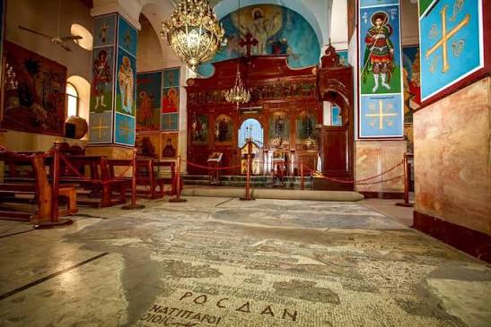
The Romans renamed Judaea as Syria Palaestina. Does that settle anything? Of course not. The Byzantine Madaba mosaic depicts Palestine. Does that settle anything? Again, no. Medieval Christian maps centred on Jerusalem in sacred geography. Ottoman maps organised provinces differently. British Mandate surveys imposed modern administrative precision. Each map tells us something true about the intellectual world in which it was created. None provides a final moral verdict on contemporary sovereignty.
Indeed, Suárez’s own broader argument may unintentionally reinforce precisely this conclusion. If maps embody cultural assumptions, then every historical map deserves to be interpreted rather than worshipped.
Greenstein continually circles back to Zionism, Christian Zionism and Israel’s contemporary use of historical imagery. Those are undoubtedly important subjects, and Suárez appears to have assembled considerable evidence for the influence of biblical geography on Western understandings of Palestine. Certainly, Christian millenarianism, evangelical theology and nineteenth-century imperial romanticism all played significant roles in preparing Western audiences to view Palestine through biblical rather than contemporary political lenses. Theodore Herzl himself undoubtedly benefited from Christian Restorationist sympathies.
But there is a wider lesson here that transcends this particular conflict.
Every nation engages in historical cartography. Vladimir Putin’s Russia speaks of Novorossiya and Russkiy Mir not simply as geographical expressions but as historical claims carrying contemporary political force. Chinese maps in the South China Sea Chinese maps invoke imperial precedents, the Nine-Dash Line and ancient tributary systems. Serbian nationalism continually remembers Kosovo Polje – “the Field of Blackbirds”. Irish nationalists remember King James I’s plantations and the partition of 1922 as Irish republicanism and unionism each produce their own historical maps of belonging. America’s has exceptionalism long rested upon maps of westward expansion under Manifest Destiny, as though the movement of a frontier line itself conferred legitimacy, whilst Confederate memory endures still. Australian history has increasingly become a contest between colonial cadastral maps and Indigenous maps of Country, each representing profoundly different understandings of what land means.
Historical geography is always political because memory itself is political. The danger comes when maps cease to illuminate history and begin adjudicating morality.
Ultimately, maps are magnificent servants but poor judges. They reveal where rivers flowed, roads were built, towns and cities grew, frontiers shifted and kingdoms expanded. They help us visualise change across centuries. They expose forgotten worlds and vanished assumptions. But they cannot tell us who possesses superior historical virtue, nor can they determine which descendants inherit exclusive political rights today.
Perhaps that is the deepest weakness of that “myth of fingerprints”. It mistakes continuity for purity, geography for identity and nomenclature for legitimacy. Human history is untidy, layered and recursive. It resembles less a straight line than a palimpsest, where each generation writes over earlier inscriptions without entirely erasing them. The old text remains faintly visible beneath the new. Maps help us read those layers. They do not resolve them.
In that sense, whether one approaches Palestine Mapped as a work of cartographic history, a study of religious imagination or an intervention in the politics of Zionism, its greatest contribution may not lie in proving who was “there first”. Rather, it reminds us that every map is itself an historical artefact, reflecting the assumptions of those who drew it. The irony is that this applies not only to the maps reproduced in Suárez’s book, but also to the intellectual maps brought by its readers and reviewers. We all chart the landscape according to our own compass bearings. The challenge is not to pretend otherwise, but to remain aware that our own map, however detailed, is never quite the same thing as the territory itself.
Coda: maps cannot be manifestos
One of the limitations of reading about maps is that like maps themselves. they flatten experience.
I’ve visited the church of St. George at Madaba in Jordan and stood next to the sixth-century mosaic of the Holy Land (pictured at the head of this post). It is a thing of beauty, of history, and of humanity. One is struck not only by its artistry but by its humanity. It is not a political manifesto disguised as a map. It is an act of devotion. The craftsmen who laid those tesserae were not anticipating twenty-first century debates over sovereignty. They were trying to depict the sacred geography through which they understood God’s world. Their “facts on the ground”, to use a phrase now freighted with controversy, were the footprints of Jesus and his Apostles.
Our Jordanian guide is part of that story. A Palestinian Christian, proud of a Byzantine mosaic in modern Jordan, her job is to guide visitors through a landscape that has been Roman, Byzantine, Arab, Crusader, Mamluk, Ottoman and Hashemite. She herself embodies the layered history that the “myth of fingertips” tends to erase. Human beings are often palimpsests long before maps are.
As we have noted, there is habit of turning historical geography into moral geography. And yet, none of these are really arguments about geography – they are arguments about memory the stories nations and peoples tell themselves.
To borrow and invert the English poet John Donne, “no man (or map) is an island”. Maps are relational documents. They acquire meaning only through the people who draw them, use them and argue over them. Detached from those human stories, they become little more than coloured parchment. Attached to them, they become objects of extraordinary emotional power.
There is another irony lurking here – that prefigured in the quotation that opened this essay. In a short story, Argentinian author Jorge Luis Borges imagined an empire whose cartographers became so obsessed with accuracy that they eventually produced a map at the scale of one-to-one, covering the entire empire itself. The map became indistinguishable from the territory and therefore useless. Political history sometimes commits the opposite error: we mistake the map for the territory. We argue over symbols as though they were reality itself.
My Collins atlases, the Madaba mosaic, Ptolemy, Ordnance Survey maps, Google Earth – all are ways of seeing. None is the land itself. The land has always contained more languages, more memories, more ancestors and more contradictions than any map can accommodate.
“The myth of fingerprints” captures the seductive belief that somewhere, if only we point to precisely the right place on precisely the right map at precisely the right moment in history, all our moral and political arguments will dissolve into certainty.
History has never been that obliging. It is less a straight line than a palimpsest. The fingertips point confidently enough. It is the ground beneath them that refuses to stand still.
The Map on the Wall
It is an education to view an old map that was not so long ago a snapshot of the world as it was geographically: Bacon’s Standard Map of the World, dating from about 1930 and drawn on the old Mercator projection. It is, at first glance, merely an antique map. In fact, it is a portrait of a vanished world.
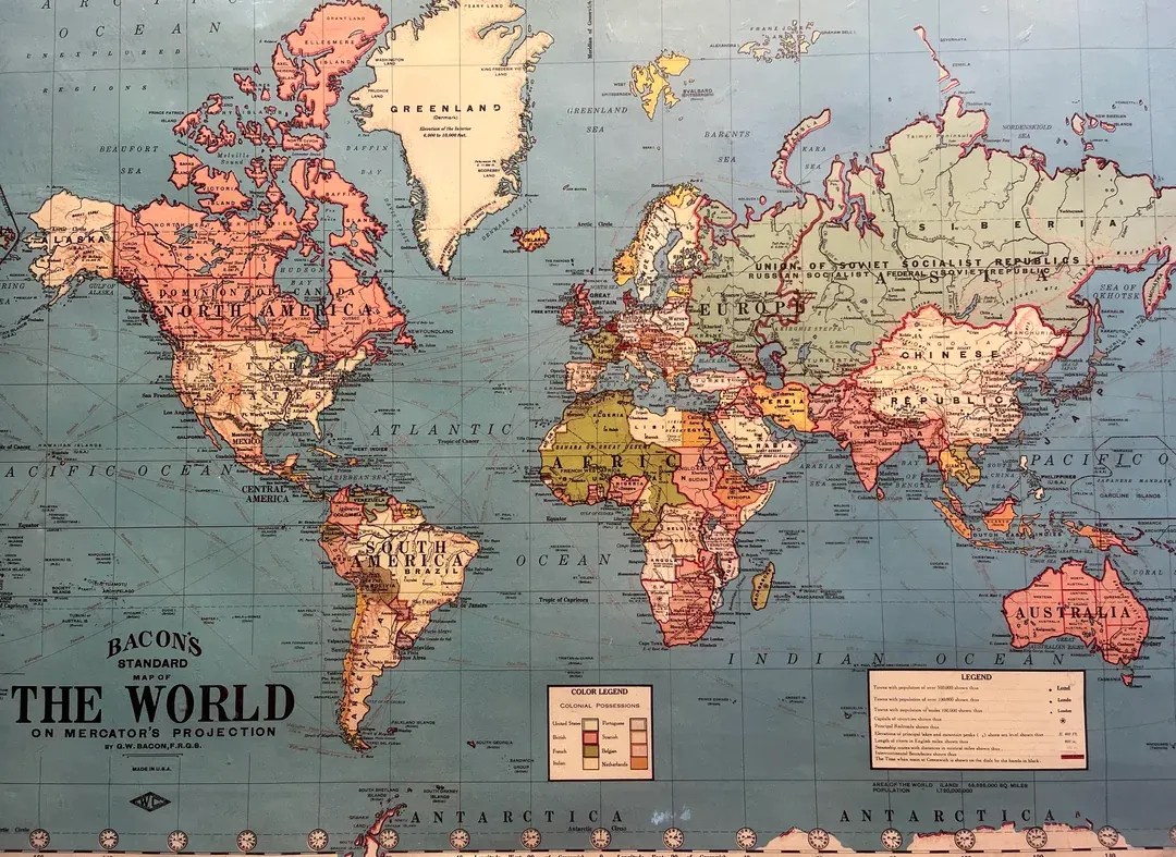
The first thing that strikes the modern eye is the colour. The great pink expanses are British; the green ones French. Empire is not something the map explains because, in 1930, it scarcely needed explaining. It just was! .
Africa is largely divided between European powers. India, Pakistan and Bangladesh are the Raj. China is a republic. Iran is Persia. The Baltic states are independent. Germany includes Konigsberg in East Prussia, now Kaliningrad. Lemburg is Lemburg, in Poland, rather than Lviv, in Ukraine. Even the names have become historical artefacts.
Palestine, Transjordan and Iraq are tiny pieces of the British imperial jigsaw. The map predates the State of Israel, Jordan, the Palestinian national struggle in its modern form and the territorial arrangements that emerged from the collapse of the Ottoman Empire and the end of European empire. The great arguments that now seem immemorial were, when this map was printed, still largely unfinished arguments. New states have now appeared where old ones disappeared; boundaries that once seemed immutable are redrawn, sometimes peacefully and sometimes in blood.
That is one of the great lessons of cartography. We tend to mistake the map we inherit for the world itself. Borders acquire the appearance of permanence; names acquire the authority of fact; colours make political control look geographical and geography look natural.
Mercator himself was not attempting to deceive anyone. His projection was designed for navigation, where maintaining accurate bearings mattered more than preserving the relative size of continents. Yet every projection makes choices, and every map consequently tells only one version of the world. The Bacon map adds another layer: it colours the world according to the political realities of its time. Geography and power are superimposed upon one another.
The map is a kind of silent witness to the contingency of history. What appears to us as the settled political geography is, viewed from the perspective of 1930, only one moment in a much longer process of imperial collapse, national awakening, migration and territorial invention.
Perhaps that is why old maps are so strangely affecting. They show us not merely where the world was, but what people once imagined the world to be. And once we recognise that, the boundaries on our own maps begin to look a little less eternal.
Paul Hemphill and In That Howling Infinite, July 2026
Thomas Suárez is a New York–born author, historical researcher, lecturer, and accomplished concert violinist and composer, now based in London. He writes and speaks frequently on Palestine, and his critically acclaimed book Palestine Hijacked: How Zionism Forged an Apartheid State from River to Sea has been hailed by historian Ilan Pappé as “a tour de force”. His other works include Writings on the Wall: Palestinian Oral Histories and Palestine Mapped: From the River to the Sea in Early Geographic Thought.
In That Howling Infinite has recently published a long essay explaining its position with regard to what is probably the most intractable conflict in modern times: One Land, Two Peoples: History, Memory, Continuity, and Inheritance
See also in In That Howling Infinite, Modern history is built upon exodus and displacement and Visualising the Palestinian Return – the art of Ismail Shammout
The featured picture at the head of this blog post of the interior of St George’s Greek Orthodox Church in Madaba, Jordan, home of the sixth century Madaba map.
* A list of Collins abd Harper Collins historical atlases follows Greenstein’s review.
How the West’s earliest mapping of Palestine continues to shape its understanding of Zionism today
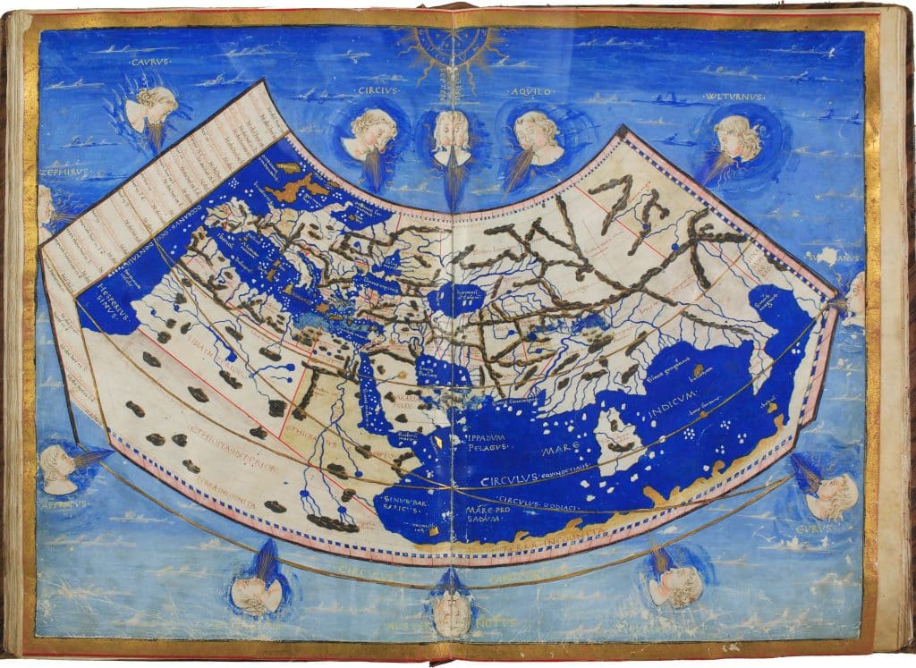 The World According to Ptolemy (2nd century), an Italian manuscript, 1460. (National Library of Naples, Library of Congress)
Palestine Mapped. From the River to the Sea in Early Geographic Thought
Thomas Suárez
Tom Suarez is one of the most meticulous and careful researchers on Palestine and Zionism although he is relatively unknown. His first book, which the Zionists did their best to prevent being publicized, disrupting his speaking tours, The State of Terror was a majestic tour de force of the Zionist terrorism that created the Israeli state and their strategies for the future ethnic cleansing of Palestine.
Suarez’s second book, ‘Palestine Hijacked – How Zionism Forged an Apartheid State from the River to the Sea’ was another tour de force. As Ilan Pappe wrote, Suarez showed how “The use of terror was deliberate and sustained, carried out or supported by the same leaders who then established and led the Israeli state. We are still living this history: The book proves that Israel’s regime of Apartheid against the Palestinians and the continued expropriation of their country are not the result of complex historical circumstances, but the intended, singular goal of Zionism since its beginning.
It is not surprising that Suarez’s latest book is in the tradition of his previous books even if it concentrates mainly on the visual rather than the verbal.
Palestine Mapped guides the reader through the Greek and Roman concepts of Palestine, the various medieval Mediterranean civilizations and the European Christian “Holy Land” mapping that has dominated since the Reformation and continues to inform modern political thought. This isn’t simply a book about cartography or map making but how notions of the ‘Holy Land’ and Palestine informed the maps and visual representations that were produced.
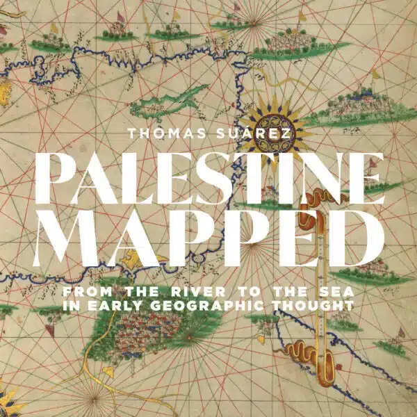
A beautifully illustrated book on the mapping of the river to the sea might seem a luxury disconnect given that Palestinians are being massacred daily. Suárez is very much aware of this. He explains in his Introduction why the ongoing genocide in fact makes the topic all the more relevant. Perhaps key to this is the subtitle’s final word, geographic thought.
Much of the West’s fanatical support for Israel is rooted in Evangelical messianism, the psychosis (to use the author’s word) that the Israeli state is the place in the Biblical Genesis, “placing it apart from the realm of all other earthly nations and securing wide Christian devotion.”
Suarez argues that this collective elite and religious mindset is powered by our own geographic wiring, and that the book is intended in part as an antidote to what he calls the “mapping of the Holy Land” narrative.
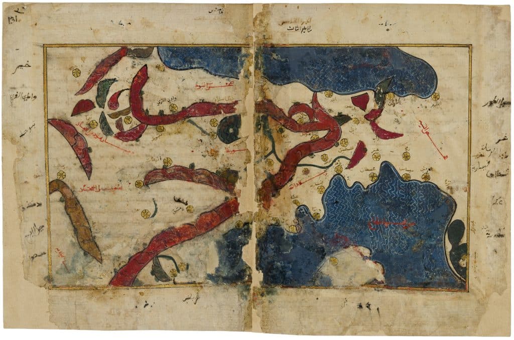
Al-Idrīsī, map of the Levant, mid-12th century (National Library of France; Image Library of Congress)
Since the book is organized roughly chronologically, its real-world relevancy is borne out mostly in the final chapter — though the Israeli state’s manipulation of ancient maps is already demonstrated with the sixth century ‘Madaba’ map.
The book begins with the earliest extant mapping of the Levant, that of the Greeks and Romans, then devotes two chapters to the medieval period. The first addresses mapping by Europeans in which Palestine is a focus: those from the distance of the Church, and that of on-the-scene pilgrims.
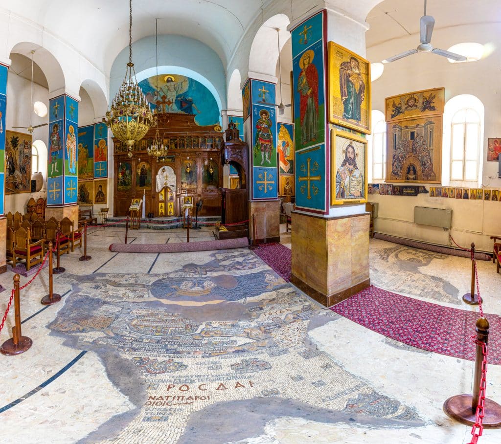
The interior of the Church of St. George, Madaba, Jordan, and the remains of a mid-6th century mosaic map of the Levant.
The second addresses mapping in which Palestine was not the focus, but through which the mapping — and Western perception — of Palestine nonetheless evolved: sea charts, advanced world maps, Ptolemy’s Geography, and what the author calls ‘Arabic’ mapping, a term used in place of the usual ‘Islamic’ mapping of academia, which he considers to be flawed terminology.
The book then arrives at what is described as the pivotal year of 1500. Three revolutions of the period are said to influence Palestine’s future: Europeans’ dramatically widened world view, the advent of printing, and above all, Lutheranism.
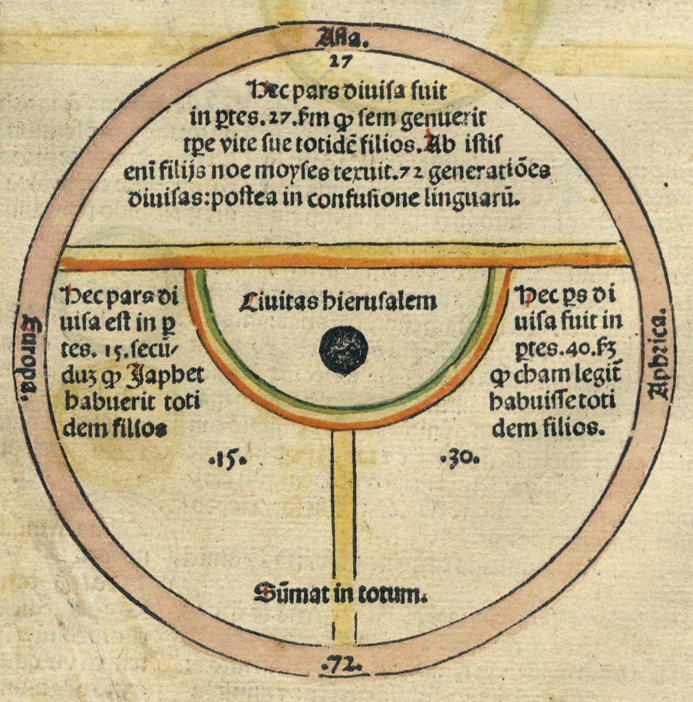
World map in the Fasciculus Temporum of the Carthusian monk, Werner Rolewink, 1484. Woodcut.
The future stage is set during that century, and Suárez gives short shrift to the years 1600-1800, other than to establish the rise of proto-Zionist ideology.
European mapping of Palestine during that period is said to be stuck in a time warp, Biblically oriented no matter the variety of renderings, in stark contrast to Europe’s mapping of the rest of the world, which was a quest for the latest, the most accurate. It is, however, here that today’s manipulation of geographic thought is first addressed, because a 1714 work of one Adriaan Reland is cited today to erase Palestinians (for which Reland is said to be blameless).
The final, long chapter begins at the year 1800, at which simmering Christian Zionist ideology takes active form with the confluence of Christian millennialism, Western imperialism, and advanced mapping techniques.
The end of the century brings of course Theodor Herzl and the advent of Political Zionism. Suárez cites both Herzl’s 1896 Der Judenstaat and a map from his 1897 newsletter, Die Welt, to argue that Herzl failed to understand the opportunity Christian Evangelicalism offered his project. I’m not so sure that this is true. One of his main supporters was William Hechler, the Chaplain at Britain’s Vienna Embassy, where Herzl was living.
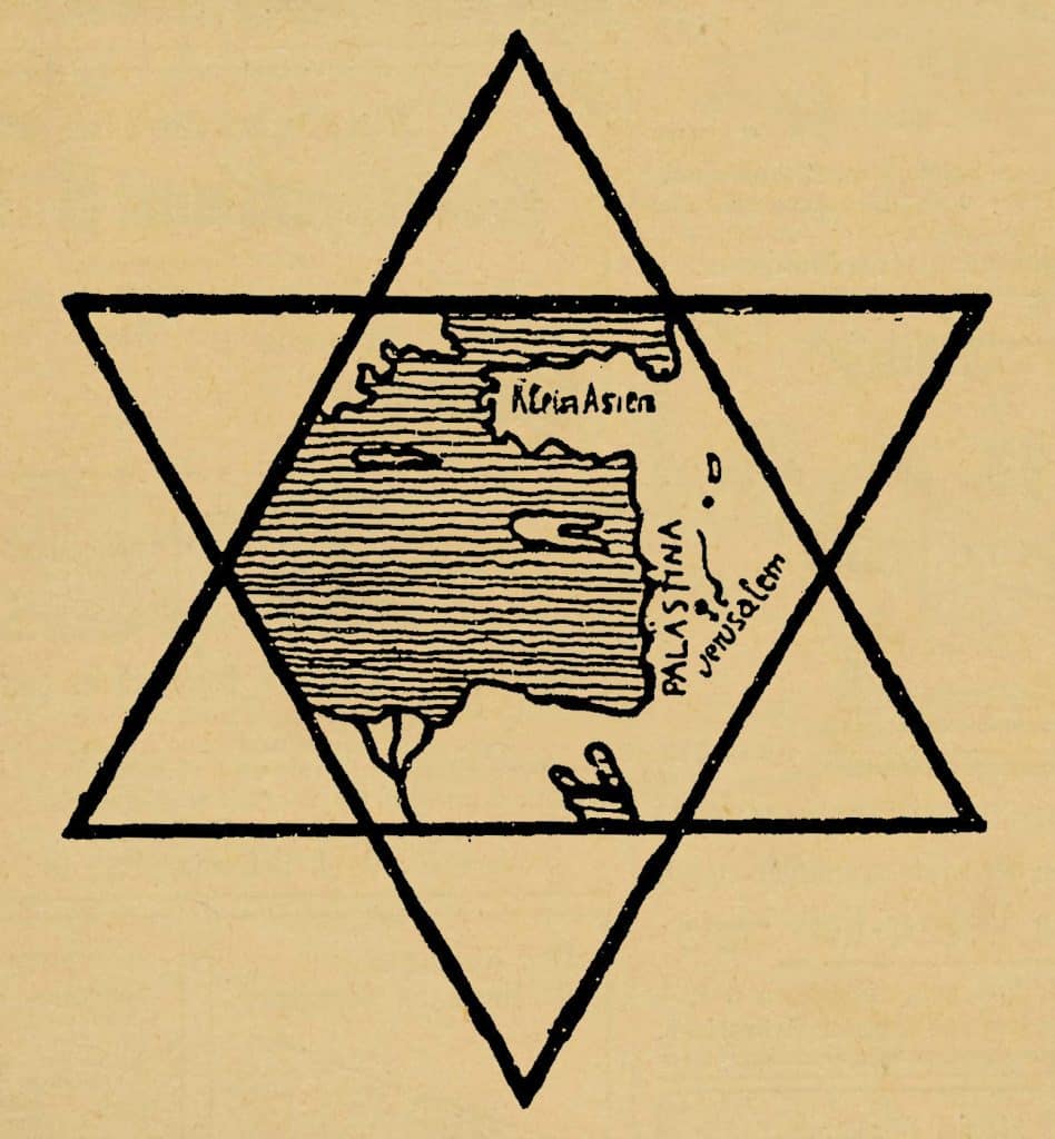
Hechler believed firmly that the Jews must be enabled to resettle in Palestine in order to hasten the second coming of Christ. He was constantly looking forward to a fulfillment of Biblical prophecy along these lines. He presented a memorandum to Lord Salisbury, the British Prime Minister, urging him to take up the cause of the Jewish return to Palestine even before he had met Herzl or read the “Jewish State”.
Hechler had been a tutor to the Grand Duke of Baden, and he introduced Herzl to him and also to the ex-Kaiser Wilhelm II. He also accompanied Herzl to Palestine where he met Kaiser Wilhelm II in Jerusalem.
Herzl had an instructive meeting with the Grand Duke April 23 1896 in Karlsruhe and he noted in his diaries that Grand Duke
‘took my project for building a state with the utmost earnestness. His chief misgiving was that if he supported the cause, people might accuse him of anti-Semitism’.
As Francis Nicosia, the Raul Hilberg Professor of Holocaust Studies at Vermont University observed:
‘whereas today non-Jewish criticism of Zionism or the State of Israel is often dismissed as motivated by a deeper anti-Semitism, in Herzl’s day an opposite non-Jewish reaction, one of support for the Zionist idea, might have resulted in a similar reaction.’
With Herzl’s death, Zionism continued to receive the enthusiastic endorsement of Christian Zionism and its millenarian supporters. Prominent supporters included Arthur James Balfour who combined antisemitism and Zionism effortlessly.
The 1947 UN Partition map receives its due attention: the author deconstructs it as a scam intended to produce the opposite result.
Suarez analyses the manipulation of geographic thought employed by Israel’s propagandists and argues that the ‘pro-Palestine’ community defeats itself by engaging with this propaganda on its own terms.
Put in its crudest form, when Zionists say ‘there was never such a place as Palestine’, we respond with an old map in which the entire land is called ‘Palestine’, or other such ‘evidence’.
Suárez argues that this is a mistake, a trap, the result of cultural conditioning:
we are geographically hard-wired to accept [that] the ancient origins of a place-name has the power to grant or deny personhood today, to justify the expulsion of anyone to whom that geographic name is or is not attached.
This is a heavily cross-disciplinary work, and it is hard to imagine anyone with Suárez’s background in the Palestinian issue who is so experienced in the history of cartography. It strikes me that this might be a book that can bring the Palestinian issue to a wider audience: Everyone, it seems, loves old maps, and perhaps this book is the perfect Trojan Horse gift for acquaintances who believe they are fair-minded but can’t quite make the break from Israel.
The reader is disarmed by the earlier ‘apolitical’ part of the book, gradually drawn into cultural conditioning addressed in the middle part, and already long engrossed when encountering the final chapter. But it is also a cautionary work for those long active in the issue of Palestinian liberation, who, as with all aspects of the issue, often disempower themselves by responding to Israel’s propaganda on its own terms.
Tony Greenstein
Tony Greenstein is a longstanding Jewish anti-Zionist and an anti-fascist activist from Brighton. In 1982 he was a co-founder of Britain’s Palestine Solidarity Campaign. Tony was suspended from the Labour Party in 2016 and expelled in 2018 as a result of the antisemitism witch-hunt–the first Jewish person to be expelled. Tony is the author of The Fight Against Fascism in Brighton and the South Coast. He has written extensively on Palestine and Zionism for, amongst others, the Guardian’s Comment is Free, the Journal of Holy Land and Palestine Studies, Tribune and the Weekly Worker. Tony was the child of an Orthodox Jewish Rabbi and when young a member of the religious Zionist Bnei Akiva, now part of the Greater Israel movement.
Historical Atlases
My collection of Collins and Harper Collins historical falls into five broad groups:
General World History
- Collins Atlas of World History – Geoffrey Barraclough, Collins
- HarperCollins Atlas of World History – Geoffrey Barraclough, HarperCollins
- History of the World in Maps: The Ultimate Cartographic Exploration of Our Past – Philip Parker, Collins
- The Times Complete History of the World – The Times / Collins
Military, Political and European History
- The Times Atlas of the Second World War
- Atlas of the Crusades – edited by Jonathan Riley-Smith
- Atlas of European History
Archaeology and Exploration
- Past Worlds: The Times Atlas of Archaeology – also published as the HarperCollins Atlas of Archaeology
- The Times Atlas of World Exploration
Biblical History and Geography
- HarperCollins Atlas of Bible History – James B. Pritchard
- HarperCollins Atlas of the Bible
- HarperCollins Concise Atlas of the Bible
5. Biblical Geography – Evangelical Reference
- NIV Atlas of the Bible – Zondervan / HarperCollins
There are 13 titles, although a couple represent different editions or titles of essentially the same work: The Collins Atlas of World History and the HarperCollins Atlas of World History are essentially the Barraclough atlas in different editions/imprints [Henry Barraclough was a renowned British historian, historiographer, and medievalist. I read his The Meaning of History back when I was in Sixth Form at Moseley Grammar School] Past Worlds and the HarperCollins Atlas of Archaeology anre alternative titles/editions of the archaeological atlas. The HarperCollins Atlas of the Bible and Concise Atlas of the Bible are related but distinct editions. The HarperCollins Atlas of Bible History is a separate, more specialised biblical-history work.
In chronological and subject breadth the collection isn’t simply a collection of history books with maps. It is almost a cartographic library of human history:
Prehistory → Archaeology → Ancient Near East → Biblical world → Greece and Rome → Christianity → Crusades → European kingdoms and empires → exploration → global history → the Second World War → the modern world.
And that perhaps explains why the physical atlases mattered to me in the first place. Their great virtue was not merely the information contained in them but the ability to see history spatially: peoples moving, empires expanding and contracting, frontiers shifting, trade and exploration routes opening, armies advancing and retreating, and religious and political worlds overlapping.
They are heavy both literally and figuratively, providing a way of understanding history that a conventional chronological narrative often cannot: history as movement across landscape and time.

